


Timeline: When Hawaii will start feeling Hurricane Lowell's impacts
Timeline: When Hawaii will start feeling Hurricane Lowell's impacts

Kieran Sullivan Sun, September 6, 2026 at 9:35 AM UTC
0
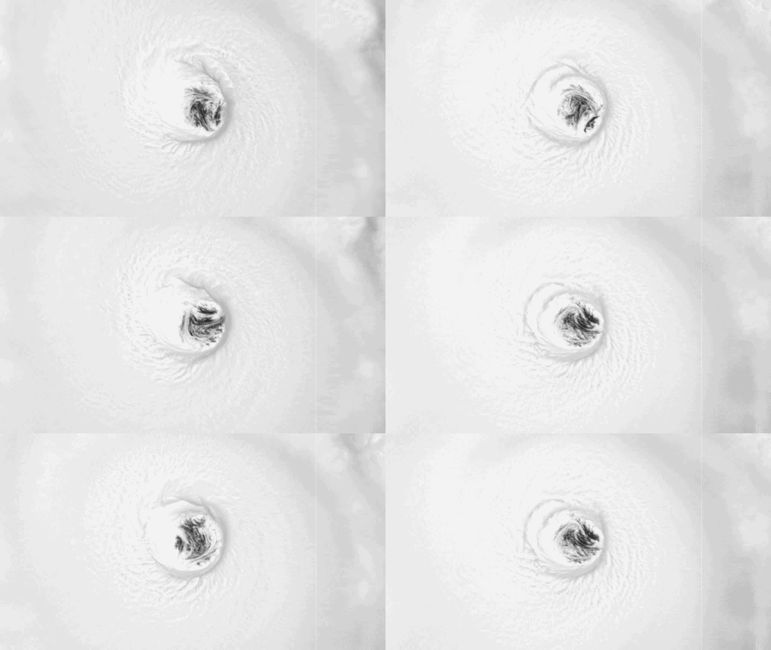
Hurricane Lowell raged at Category 4 strength on Friday, Sept. 4.
Sunday: Hawaii's impacts begin with showers and thunderstorms across the island chain.
Monday: Lowell makes its closest approach with the potential for tropical storm-forced wind gusts.
Tuesday: Lowell pulls away, but hazards linger, including the threat of flash flooding.
Hurricane Lowell is forecast to make a sharp turn north in the Pacific Ocean over the coming days, bringing a growing threat of dangerous surf, flooding, rain, strong winds and coastal impacts to Hawaii.
Lowell Intensifies Back To Monster Category 4 Hurricane Ahead Of Turn Toward Hawaii
As the storm churns across the Central Pacific, here's a day-by-day look at Lowell's forecast and when Hawaii is expected to begin feeling its impacts.
High surf and dangerous rip currents will continue to build through Sunday afternoon across the Hawaiian island chain, with coastal advisories in effect and waves of up to 14 feet expected.
Track Hurricane Lowell: Path, Forecast Cone, Spaghetti Models, Wind And More
Meanwhile, preparations should be well underway on Kauai, as this may be the last meaningful window to secure property and finalize plans before conditions rapidly deteriorate with Lowell's approach.
On Sunday, Lowell is moving north and has slowly weakened to a Category 3.
Ahead of the storm, increased tropical moisture will usher in showers and thunderstorms across much of the island chain.
High Surf Advisories are likely to remain in effect through the end of the weekend as Hurricane Lowell inches closer. Waves are expected to build even higher across the western Hawaiian Islands, including Kauai, with offshore seas reaching 15 feet or more overnight.
2026 Atlantic Hurricane Season Nears Historic Territory For Latest First Hurricane Amid Looming Super El Niño
Across the western Hawaiian Islands, impacts will begin on Monday.
Advertisement
Lowell's center will likely be around 300 miles southwest of the island chain by midday.
By afternoon, winds will begin increasing across Kauai and Oahu, with tropical-storm-force gusts possible on Kauai into the overnight hours.
Wind gusts of 30 to 40 mph will also be possible farther east on Oahu, and rain will continue across the island chain as southerly winds push moisture into the southern portions of the islands.
Major Hurricane Lowell Could Follow Eerily Similar Track To The Worst Hurricane In Hawaii's History
Surf will peak overnight Monday as Lowell makes its closest approach.
Waves over 20 feet will be possible along south and west-facing coastal areas of Kauai and Oahu, creating dangerous surf and the potential for coastal erosion.
By Tuesday, Lowell will continue weakening as it accelerates northward.
Rain will begin to slow during the afternoon but could remain moderate across the western islands, while dangerous surf continues.
Tropical-storm-force winds are expected to impact Kauai from Monday night through early Tuesday morning before gradually diminishing by Tuesday evening.
How To Watch Fox Weather
As Lowell pulls away, surf will slowly begin to subside, but not before parts of the island receive 5–8 inches of rain, with localized totals approaching a foot, increasing the risk of flash flooding.
Stay with FOX Weather for the latest updates on Hurricane Lowell’s track, intensity and future impacts.
Original article source:Timeline: When Hawaii will start feeling Hurricane Lowell's impacts
Source: “AOL Breaking”
